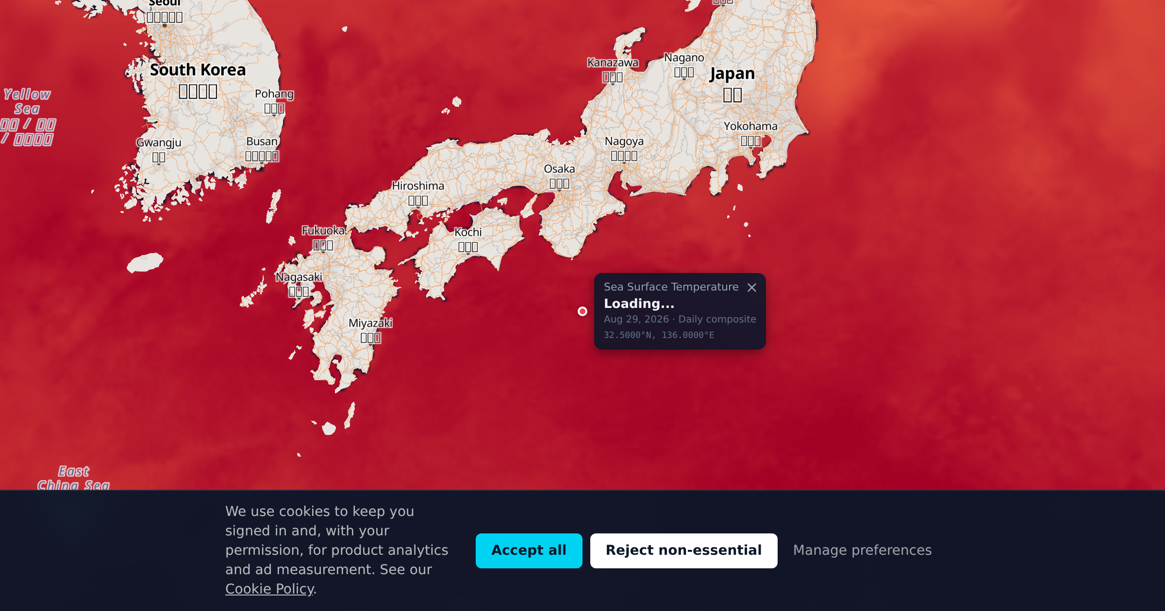
The Kuroshio is the second strongest western boundary current in the world, and it runs straight up Japan's Pacific coast at speeds that can exceed four knots. Where it meets the cold Oyashio flowing south from the north, off the Kanto coast, the two form one of the sharpest and most productive ocean fronts anywhere. That collision is why this coastline supports bluefin tuna, yellowtail, and a bottom fishery that has been worked continuously for centuries.
This region covers the Pacific side from Kyushu north through Shikoku and Honshu to the Kanto coast, plus the Izu Islands chain running south from Sagami Bay. The Kuroshio does not follow a fixed path. It swings between a straight course hugging the coast and a large meander that pushes it hundreds of miles offshore, and which state it is in changes the fishing more than any calendar month does.
Species and Seasons
Pacific bluefin tuna (kuromaguro): The signature species. Best June through October along the Kuroshio front and around the Izu Islands. Juvenile fish are available far more widely than the large ones. Tightly managed under international quota, and regulations change, so check current rules before targeting them.
Yellowtail amberjack (buri or hamachi): The classic seasonal fishery. Fish migrate north in spring and back south in autumn, with the prized cold-season kan-buri taken December through February. Found on reef edges, seamounts, and current lines. The autumn run down the Pacific coast is the peak.
Greater amberjack (kanpachi) and gold-striped amberjack (hiramasa): Warmer-water relatives of buri, best May through October. Held on offshore pinnacles and around the Izu Islands. Jigging over structure in 100-300 feet is the standard method.
Skipjack tuna (katsuo): Two runs. The northbound spring fish arrive off Kyushu and Shikoku March through May, and the fatter southbound autumn fish come through September through November. The spring run following the Kuroshio north is the traditional fishery.
Japanese Spanish mackerel (sawara): Spring and autumn on both runs, held over shallow banks and along tide lines. A light-tackle casting and jigging target.
Blue marlin and striped marlin (kajiki): June through October in the warmer Kuroshio water, fished offshore of the Izu Islands and off the Kii Peninsula. Striped marlin arrive slightly earlier and in cooler water than blues.
Alfonsino and splendid alfonsino (kinmedai): A deep bottom fishery in 600-2,000 feet on the seamounts around the Izu chain. Best in the cooler months, November through March. Electric reels and heavy sinkers.
Japanese horse mackerel (aji) and mackerel (saba): Year-round nearshore. Aji hold on structure and in harbours, saba school over open ground. Both are the bait base the larger pelagics work.
Diving the Izu Islands
Mikomoto Island off the southern Izu Peninsula is the best known big-animal site in mainland Japan. Strong current over a small rock pinnacle draws large schools of scalloped hammerheads through the summer, typically July through October. It is an advanced current dive.
Hachijojima, further down the Izu chain, sits in warmer Kuroshio water and holds a genuinely subtropical reef community at a latitude that should not support one. Sea turtles are resident and visibility is consistently good.
The Izu Peninsula has extensive shore diving from Osezaki and the Izu Oceanic Park. Osezaki is a muck and macro site with a long list of rare species, and it stays diveable through winter when visibility is at its best.
Water on the peninsula runs 59°F in late winter to 79°F in late summer, so a wetsuit choice here is genuinely seasonal. The Izu Islands stay warmer year round because they sit in the current rather than beside it.
Why SST and Chlorophyll Matter Here
This is a region where SST is the primary tool rather than a supporting one. The Kuroshio front is a hard thermal edge that can drop 15°F over a few miles, and it is the single most important feature on the water. Finding it is finding the fishing.
The current's path is not fixed. In a large-meander state the Kuroshio bends far offshore south of Honshu, leaving cooler water against the coast and pushing the productive edge well out. In a straight-path state it runs tight to the coast and the fishing comes in close. SST imagery shows which state it is in on any given day, and the meander can persist for years at a time.
Warm-core rings pinch off the main current and drift, carrying tropical water and the species that travel with it into cooler surrounding water. These rings are clearly visible as circular warm anomalies and they are productive on their edges rather than in their centres.
Chlorophyll adds the second half. The Kuroshio itself is warm, clear, and nutrient-poor. The Oyashio coming south is cold and rich. Where they meet, the mixing produces one of the strongest spring blooms in the Pacific, and the chlorophyll gradient marks the biological edge that the temperature gradient only implies.
Fishing & Diving Calendar
March-May: Spring. Northbound skipjack off Kyushu and Shikoku. Sawara on both coasts. Kuroshio-Oyashio bloom building. Amberjack moving north. Water 59-68°F.
June-August: Summer. Bluefin along the front. Marlin offshore of the Izu chain. Kanpachi and hiramasa on the pinnacles. Hammerheads at Mikomoto. Water 72-79°F.
September-November: Autumn. Southbound skipjack, fat and prized. Yellowtail run building. Bluefin still present early. Typhoon season through October. Water 68-77°F.
December-February: Winter. Kan-buri yellowtail at their best. Kinmedai deep fishery peaks. Best visibility of the year on the Izu Peninsula. Water 59-64°F.
Fishing nearby waters too? Flores / Timor Sea and Bali / Java Sea are the closest covered regions. See pricing for what a plan covering Japan costs.